Quick Summary
- Ancient Origins: The Cape to Cape Track follows routes once used by the Wardandi people, the traditional custodians of this land.
- Modern Development: The idea for a formal trail emerged in the 1970s, with construction beginning in the late 1980s. It was completed in 2001.
- Trail Construction: Building the track involved connecting existing paths, beach walks and forest trails, meaning significant planning and manual labor.
- Optimal Hiking Times: The best periods to hike the trail are during spring (September–November) and autumn (March–May), offering mild weather and vibrant natural displays.
Jump to Section
The History of WA’s Cape to Cape Track
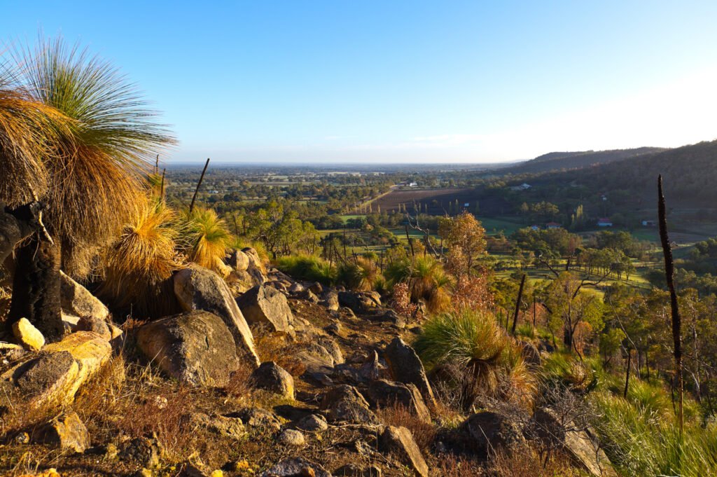
This is a long one… about 125 kilometres long, hugging the Leeuwin-Naturaliste Ridge, the Cape to Cape Track offers hikers a journey through diverse terrains and rich cultural landscapes. From its ancient origins to its modern-day popularity, the trail speaks volumes about Western Australia’s southwest.
Amazingly, for such a well-trodden trail, the Cape to Cape’s history isn’t all that long. Unless you’re talking about the ancient cultures who called the area home for thousands of years…
An Ancient Pathway
For over 60,000 years, the Wadandi people—also known as the Saltwater People—have traversed this region, establishing deep connections with the land and sea. Their traditional routes or ‘bidi’, ran parallel to the coast, linking significant sites such as Kwirreejeenungup (Cape Naturaliste) and Talanup (Cape Leeuwin).
These paths facilitated not only travel but also the sharing of stories, songs and cultural practices that remain integral to the Wadandi identity today.
Construction and Evolution of the Track

The idea of a dedicated walking trail along this amazing coastline came about in the 1970s. And by the early 1990s (yep, it took a while), solid efforts to formalise the trail took shape, linking up with existing tracks, beaches and forest paths. The Friends of the Cape to Cape Track are the true heroes of the track we know today. The organisation was established in 1998 and played a monumental role in securing funding and coordinating volunteers for the trail’s development. Their contributions were crucial in the track’s official opening in April 2001. The Friends of the Cape to Cape Track are indeed friends of ours.
Today’s Cape to Cape Track Experience
Today, the Cape to Cape Track attracts thousands of hikers every year. In 2019, over 44,000 “movements” were recorded, showing off its huge popularity. Around 80% of these hikers are from Western Australia, with the remainder comprising interstate and international visitors.
The trail is divided into several sections, each offering unique landscapes:
- Cape Naturaliste to Yallingup: Think coastal cliffs and panoramic ocean views.
- Yallingup to Moses Rock: Limestone formations and secluded beaches.
- Moses Rock to Gracetown: Diverse flora and fauna within coastal heathlands.
- Gracetown to Prevelly: Offers a mix of beach walks (long, long beach walks) and forested areas.
- Prevelly to Hamelin Bay: Includes stretches of karri forest and historical sites—and everyone’s favourite coastal cafe, White Elephant.
- Hamelin Bay to Cape Leeuwin: Finishes with rugged coastlines and the iconic Cape Leeuwin Lighthouse.
The trail is rated as a Grade 4 walk, meaning it’s suitable for experienced bushwalkers. You hikers can expect long distances of course, but also a mixture of rough (sand, rock, limestone, cliff and waterways) and limited signage in certain areas. Know before you go… scroll down to get our map of the Cape for an overview of the length.
Terrain along the track varies from sandy beaches and coastal cliffs to dense forests and rocky outcrops. This diversity not only offers scenic beauty but also presents varying levels of difficulty, making preparation essential for a safe and enjoyable hike.
For those planning their journey, get onto some detailed maps and guides. Also understanding the cultural significance of the land enhances the hiking experience, giving you a much deeper appreciation for the region’s long and rich heritage.
Download Our Cape to Cape Track Map (PDF)
Planning your hike? Download our Cape to Cape Track map to give you a taste of the treats that lay along the southwest’s most prized and beloved walking trail.
Download Cape to Cape Track Map (PDF)
When Is the Best Time to Hike the Cape to Cape?

The optimal times to hike the Cape to Cape Track are during spring (September–November) and autumn (March–May). These seasons offer mild temperatures, lower rainfall and the chance to witness wildflower blooms or whale migrations.
But it’s not that simple a question to answer when everyone’s preferences are different. That’s why we wrote our post on When Is the Best Time to Hike the Cape to Cape. Go on, check out and fling your excuses to the wind of why now ain’t the best time to hike!
A mission along the Cape to Cape Track—even for a section or a day (or an arvo)—offers not only a physical challenge but also a journey through rich cultural history and diverse natural landscapes. Take it from us, the Cape is an unforgettable experience. Respect the path, keep your fellow hikers in mind and enjoy the trail.