I love the Perth Hills. I frequent the place for outdoor rock climbing sessions, and my wife heads there regularly to switch off with a long bush walk. But beyond the activities that get our pulses racing, there’s something special about the long hurdle that we stare at when the sun rises. Something catastrophically beautiful, as if the mounds that line the eastern horizon were created through something harsh, profound, startling: because indeed they were.
The Perth Hills, with their undulating landscapes and striking escarpments, owe much of their formation to ancient geological processes, particularly movements along something called the Darling Fault.
Here’s the geological history of the Perth Hills in a nutshell, an account of the forces that have shaped this distinctive region over billions of years.
Geological foundations and the Yilgarn Craton
The story of the Perth Hills begins with the Yilgarn Craton, one of the oldest pieces of Earth’s crust, dating back over 2.5 billion years.
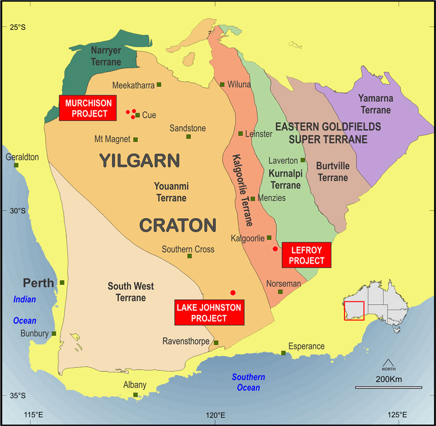
Image: Lefroy Exploration
Over the decades, this long expanse of crust has been a source of gold discovery. Explorers have apparently barely tapped into the area’s gold reserves.
Anyway, this huge expanse of ancient rock forms the foundation of much of Western Australia, including the elevated terrains of the Perth Hills. Made up mainly of granites and gneisses (tough, striped rock that forms when other rocks are squeezed and heated deep underground), the Yilgarn Craton is a stable continental block that has withstood the test of time.
Here’s why the Yilgarn Craton is important to our story.
The role of the Darling Fault
Now, an important setting in the Perth Hill’s geological three-part act structure is the Darling Fault.
The Darling Fault is one of Australia’s—yes, the entire country’s—most significant and longest faults, extending over 1,000 kilometres in a north–south direction along WA’s west coast. This ancient fault lays the boundary between the archaic rocks of the Yilgarn Craton to the east and the comparatively “younger” sediments of the Perth Basin to the west.
The Darling Fault came about during the Proterozoic Eon (a vast geological time frame spanning from 2.5 billion to 541 million years ago). Tectonic movements along this fault resulted in the uplift of the eastern block, forming the elevated landforms we now recognise as the Perth Hills.
At the same time, the western block subsided, giving rise to the Perth Basin—a sedimentary basin that has accumulated deposits over hundreds of millions of years.
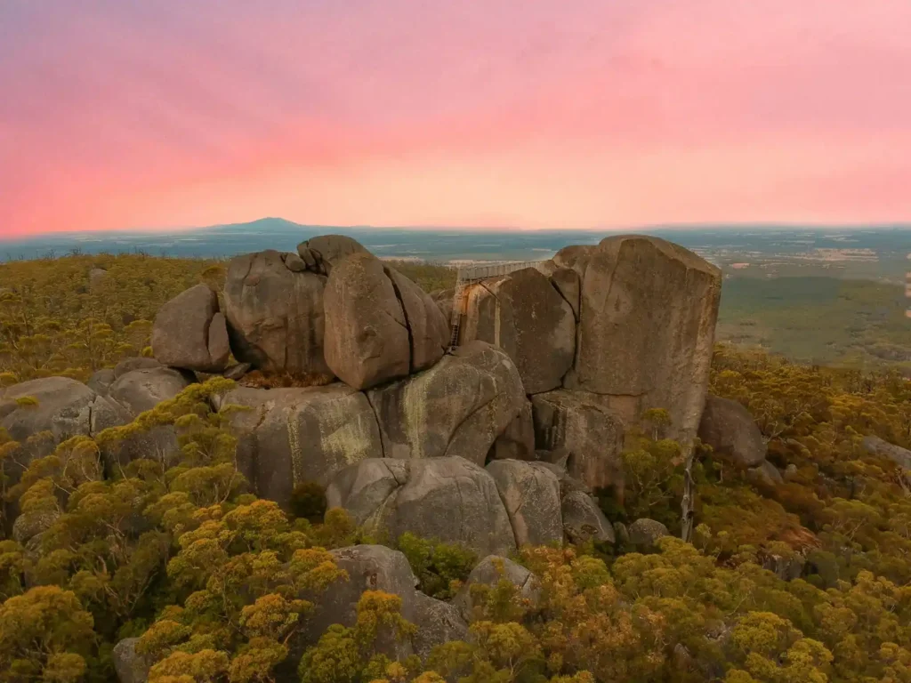
Formation of the Darling Scarp
The Darling Scarp is the prominent escarpment that marks the western edge of the Perth Hills. Its cool easterly breezes help residents lower their temperatures when the ocean air is simply too far to hit their sweaty temples. So, in the heights of summer, all hail the Darling Scarp.
Initially, the scarp coincided with the Darling Fault; but over millions of years, erosion caused the scarp to retreat eastward—yep, actually move towards Australia’s centre—distancing it from the actual fault line.
This retreat has left behind a series of foothills known as the Ridge Hill Shelf, which sits between the current scarp and the original fault location.
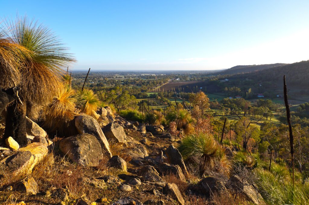
Lateritic Plateau and soil formation
At the head of the Perth Hills lies the Darling Plateau. The plateau is lined with laterite, a reddish, iron-rich soil layer that forms in tropical and subtropical regions through the prolonged weathering of underlying rock. This developed over millions of years and the process leached a tonne of minerals into the region, like iron and aluminium-rich residues.
Why’s this important?
The lateritic soils have been a growth machine for the region’s vegetation, meaning it’s helped the expanse of native species adapt to pretty nutrient-poor regions. Ever wondered why kangaroos can survive such harsh climates? Now you know.
Perth’s earthquake history
Obviously the major geological structures of the Perth Hills were established in ancient times, but the region has experienced more recent earthquake activity.
A notable event was the Meckering earthquake on 14 October 1968, which hit a magnitude of 6.5. This rumbling caused a tonne of damage in the town of Meckering, approximately 130 kilometres east of Perth, and serves as a dire reminder of the ongoing tectonic activity associated with the Darling Fault. I’m writing this in 2025… 57 years is not that much in the scheme of things.
Colouring your adventure
I’m not the only one who has a soft spot for the Perth Hills. From bushwalking to cycling to bird watching and star gazing, the place is a natural playground for lovers of the outdoors. Having a bit of insight into the blueprint that lays beneath its foundation, remembering its long and robust history and even digesting a little bit of the geological features that make the place as stunning and rugged as it is, can go a long way toward colouring your adventures in the Perth HIlls.
Want more cool insights like this? We’ve got plenty more WA wonders to digest here.