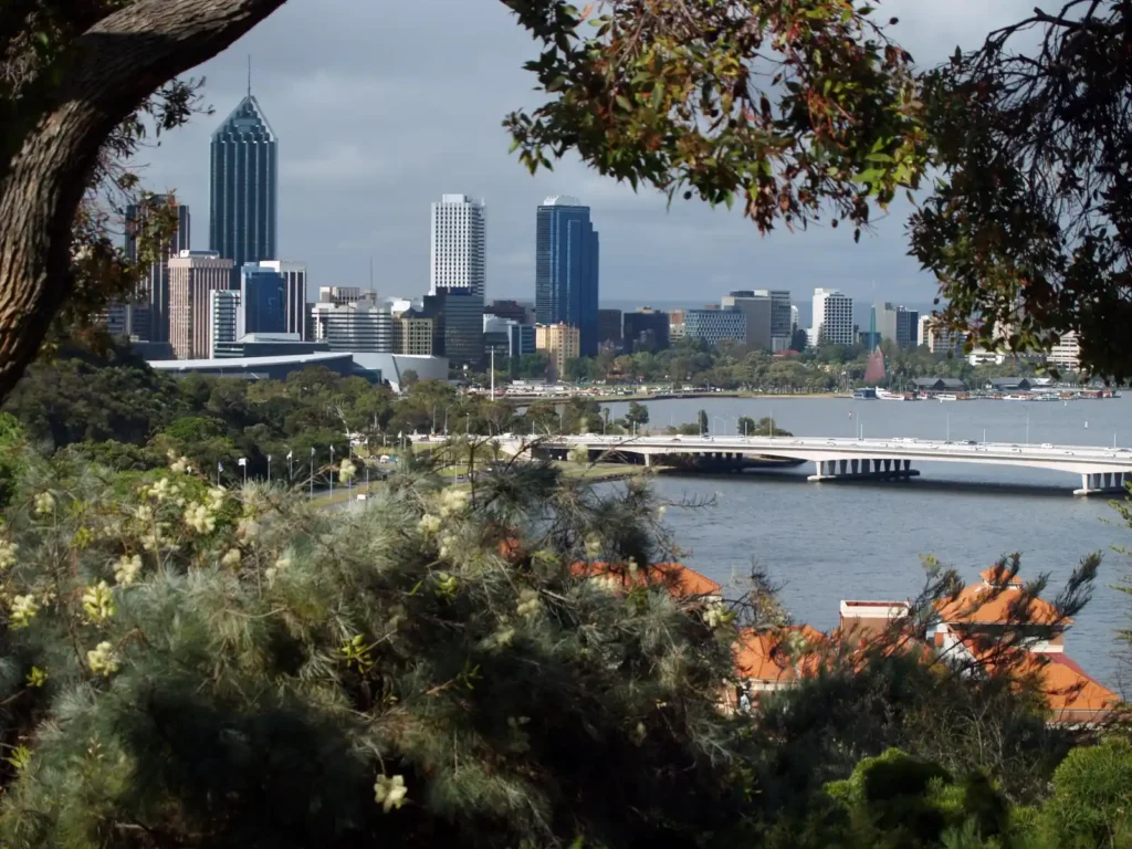
New to the city? Too eager to dirty your hiking boots before finding a car? Or maybe you’re living that commendable minimalist lifestyle that prioritises buying trail gear over a car. Whatever your reason for getting to one of Perth’s trailheads without a car, the great news is you can indeed ride the bus or the train to a tonne of amazing hiking trails around Perth.
While Perth’s sprawling boundaries means that there are some hiking trails within the CBD that would deserve double thumbs up, most Perth public transport hikes on our list will get you out of the urban jungle and into the far reaches of Perth’s regional areas. Hiking in Perth without a car is simple, thanks to its solid public transport system in our city.
How good is Perth’s public transport system?
Overall, Perth’s public transport system is pretty darn good. The buses inside the city limits are very diligent and the number of buses to outer regions (such as Jarrahdale, Serpentine and Kalamunda) very generous. It means hikers have no excuses to get out for an incredible trail walk or trail run in many of Perth’s well-known and loved regional areas.
Perth’s boundary almost rivals the footprint of Los Angeles, with the countless suburbs and precincts (growing at the fastest rate we’ve ever seen) meaning that a car is easily the preferred way for most to get around. But given the abundance of new arrivals to our state, the growing number of people preferring to live outside the city boundaries and the general need for reduced traffic congestion on our highways, the WA state government has poured a tonne into public transport into recent years.

Metronet is the hero of these projects, the single largest investment into public transport that WA’s ever seen. It includes 72km of new passenger rail and 23 new stations, from Yanchep in the north, Byford in the south, all the way into the Perth Hills with Ellenbrook getting its own train line.
It’s this connection into Perth’s outer regions that hikers and trail runners will appreciate in years to come, as more public transport projects inevitably pop up.
Okay, let’s get to it before the next bus arrives. Here are the top Perth hiking spots accessible by public transport.
Top hiking spots in Perth accessible by bus and train
1. Whistlepipe Gully
One of the Kalamunda Shire’s hiking gems, this is a 3.1km out-and-back hike, perfect for beginners or those just wanting a short stroll or a long sit in nature. It features excellent views of the area’s vibrant natural landscape, towering trees and beautiful waterfalls. The nearby Lesmurdie Falls (pictured below) can be built into the trail, which flows best between September and November.
Nearest public transport node: Situated in the growing precinct of Forrestfield (on the outskirts of Kalamunda), getting the train and bus to Whistlepipe Gully is simple. The Airport train line will drop you off at High Wycombe station where the 270 to Elizabeth Quay Bus Station will, in ten minutes, deliver you Hale Road (just after Anderson Road). It’s a 2km walk from the bus stop to the trailhead.
Transport time from Perth CBD: 1 hour 15 minutes
2. Lesmurdie Falls

One of my favourite hikes in the Perth Hills, and also situated in Kalamunda National Park, Lesmurdie Falls provides a thunderous waterfall display in the winter and post-winter months. From the bottom of the falls to the trail routes above it, you’re in for some solid climbs. The Lesmurdie Falls hike links up with Whistlepipe Gully, so if you’re looking for a long bush walk or an epic trail run, I suggest combining both neighbouring hikes.
The great thing about Kalamunda National Park, is the volume of trails that occupy its vast and exceedingly beautiful area. So, you can retrace your steps to either Lesmurdie Falls or Whistlepipe Gully on your next public transport journey to the Perth Hills, knowing that far more hiking trails are waiting for you.
Nearest public transport node: The public transport route from Perth CBD to Lesmurdie Falls shares a similar journey with Whistlepipe Gully. As with Whistlepipe, first take the Airport train line to High Wycombe station and then the 270 to Elizabeth Quay Bus Station. This time, take the bus to Anderson Road (just past Annato Place). From there, it’s a 2km walk to Lesmurdie Falls’ trailhead.
Transport time from Perth CBD: 1 hour 25 minutes
3. Ellis Brook Reserve

Home to the Sixty Foot Falls, a barrelling waterfall that is best seen after heavy rainfall in Perth’s winter months, Ellis Brook Reserve sits at the bottom of the Darling Scarp, just outside Maddington suburban area. The Blue Wren Ramble Trail is a sensational walk, and is often quiet, especially on weekdays or if you’re braving cold, wet weather to ensure you glimpse the Sixty Foot Falls in action.
Wildflowers is the first thing I picture when thinking of Ellis Brook Reserve, with the vibrant display of native flowers one of the features of the multiple hiking routes to the falls. Ellis Brook Reserve is truly worth the public transport mission, given it’s one of the longer Perth hiking options on this list accessible via public transport.
Nearest public transport node: Two buses will get you to Ellis Brook Reserve from the Perth CBD, the 221 to Armadale Station followed by the 229 to Carousel Shopping Centre. The latter drops you at Dellar Road before Lancaster Place. It’s then a 4km hike-in to the trailhead, where park benches and toilets will come in handy for a quick refuel.
Transport time from Perth CBD: 1 hour 50 minutes (includes a 45- to 55-minute walk to the trailhead)
4. & 5. Kitty’s Gorge & Stacey’s Loop
Serpentine National Park is home to one of Perth’s most iconic trails, Kitty’s Gorge, a 17km return trail that combines spectacular woodlands with huge granite outcrops and tranquil waterfalls. There’re a few steep sections on the route that’ll challenge the average hiker or trail runner, but all of it worth it for the tranquility and the solace that Serpentine’s favourite hike delivers.
It neighbours the far less challenging Stacey’s Loop, which—at just 1.9km—offers similar stunning scenery, in wildflowers, sky-high trees and very vocal wildlife, without the strenuous distance and climbs of Kitty’s Gorge.
Nearest public transport node: The nearest bus station is Atkins Street after Oak Way, leaving you with only a 350km walk to the Kitty’s Gorge and Stacey’s Loop trailheads. You may need two to three buses from the Perth CBD to get to Serpentine, as you’ll pass through the large precincts of Armadale and Jarrahdale before landing in Serpentine National Park.
Transport time from Perth CBD: 2 hours 25 minutes
6. King’s Park

I didn’t want to start the list with perhaps the most obvious network of hiking trails within the Perth boundary that a bus or train will deliver you to. But it’s probably home to some of the best hiking trails on this list.
King’s Park has a plethora of hiking trails that most Perthians don’t know about. Once you’re off King’s Park’s main arteries and busy pathways, you’ll find a web of hiking routes that wedge you between sky-high trees, put the birdsong of our stunning birds right in your ears and drown out any idea that you’re smack bang in the middle of Perth’s CBD. King’s Park is hands-down one of the best attractions in Perth to get you outdoors.
Nearest public transport node: Gosh, take your pick: on the Mounts Bay Road side of King’s Park, there are multiple bus stops. Same goes for the West Perth side, with the free CAT bus even operating within the Perth CBD.
Transport time from Perth CBD: 25 minutes (or 30 minutes if you walk)
7. Bald Park
While on the subject, another inner-city hiking spot is the coastal bound Bald Park. Situated in the stunning suburb of City Beach, Bald Park is a 437-hectare urban bushland area that shares its incredible bushland views with 180-degree visibility of the Indian Ocean.
The Zamia Trail is the choice of the many offered hiking trails at Bald Park, for its length, its diverse terrain (plenty of calf-burners) and ocean views. It’ll send you far from the carpark and into regions of Bald Park that the sounds of cars are completely replaced by brushing tree branches, whistling winds and singing birds.
Nearest public transport node: The 81 bus to City Beach will drop you on Ocean Drive, not far from Bald Park’s Quarry Amphitheatre. It’s a 1km stroll to the trailhead, the perfect hike-in before you start your urban bush crawl. Otherwise, the 28 Claremont Station-bound bus will drop you in front of the Bendat Basketball Centre, where a 1.5km walk will break your boots in before you get to Bald Park.
Transport time from Perth CBD: 50 minutes
While Perth is certainly one of those sprawling cities where a car comes in incredibly handy, it’s not beyond any visitor or new arrival to the west to enjoy this city’s impeccable hiking routes thanks to the help of its great public transport system.
Good old public transport will get you to a number of excellent hikes in and around Perth. So, no excuses whether your car is in the shop or simply non-existent. Say thanks to the bus driver, get out there and explore the many epic trails Perth’s surroundings has to offer.
Looking for your next adventure in WA? Our guides reveal the best Perth and its surroundings have to offer. Check out our explorer-written adventure guides and plan your next awesome adventure in the west!


